Frequently Asked Questions
HOW DO I GET STARTED?
Begin with a limited area that you know or have some reason to believe contains certain traces of civilization. The TRAILFINDER will go to work and mark spots for you.
Begin with a limited area that you know or have some reason to believe contains certain traces of civilization. The TRAILFINDER will go to work and mark spots for you.
HOW DOES IT WORK? That's a good question. How Dowsing works is not fully understood by science--yet. Various practitioners use unstable techniques and tools such as forked branches, wires, etc. which turn or dip in their hands to indicate the presence of underground objects or water.
In the case of The TRAILFINDER, he uses a much more stable method, an L-shaped copper pipe, held in tension, which turns down with an unmistakable gravitational pull. Unlike other unstable methods, this can be performed in a 45-mile an hour wind.
Why does it work? Geophysicists say that disrupted earth has different magnetic patterns than undisrupted earth, and that may be what causes the pull.
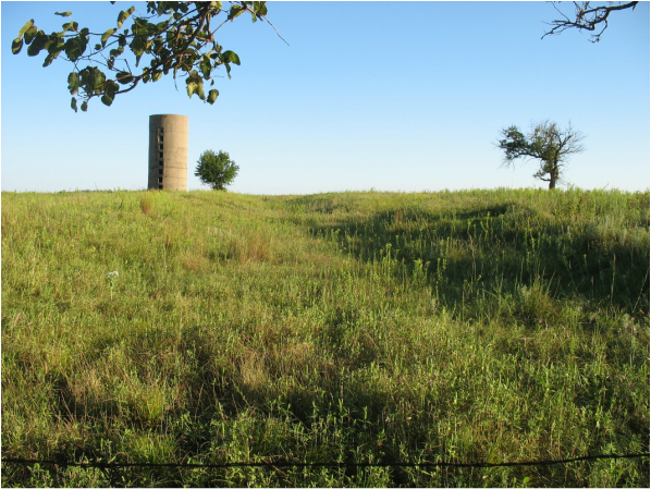
Class 1 trail rut of the Cherokee Trail, on the north side of Potwin, KS. First bypassed as a simple field gully.
HOW DO I KNOW THIS IS NOT A FAKE? OR EVEN WORSE, THAT "WATER WITCHING" IS WITCHCRAFT?
It is very typical for people to doubt the authenticity of Dowsing. Many scientific studies show negative results and few positive. The scientific method of investigation calls for testing that is observable, measurable, and repeatable. It is my goal to meet these standards.
However, if you feel this is all a fake, all you have to do is observe. Check to see if the spots marked support what is already known, such as existing maps or surveyor's documents. The TRAILFINDER does not claim to be 100% accurate, and never has. Dowsers can miss a target, and have on occasion. However, the success of TheTRAILFINDER will become evident to the observer as patterns emerge on the site. Bring a third party to watch, if you want.
Dowsing done by The TRAILFINDER is not witchcraft, occult, or anything similar. That nickname was given in colonial times when one person could do something another could not do; so of course, they thought, it had to be supernatural. Dowsing done by The TRAILFINDER is a natural phenomenon, comparable to magnetism, gravity, or why birds fly south for the winter. Some scientists and archaeologists measure the same things dowsers find, with scientific equipment such as ground penetrating radar. What others do with dowsing, or call dowsing, The TRAILFINDER is not responsible for. See page on Scientific Studies.
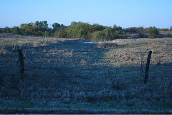
Trail rut on the north side of Section 9, Walton Township, Harvey County, about two miles northeast of Walton, KS. Class 1 trail rut.
IT IT EXPENSIVE? The TRAILFINDER will discuss in your case whether to negotiate for expenses. WHAT'S IT WORTH TO YOU TO FINALLY PINPOINT THESE TRAILS OR SITES YOU'VE WONDERED ABOUT FOR ALL THESE YEARS? Give us a call and let’s talk.
ARE YOU DOING A BOOK OR SOMETHING? Well, after publishing “Hallowed Hardwood” on old basketball gyms in Kansas, the writing bug bit hard. I would say at this point I am still gathering information on “Pioneer Trails in Central Kansas.” I have defined central Kansas as Harvey, McPherson, and Marion counties, and some trails extend outside of that area.
I’ve raised the question of, within an 8-mile radius of Goessel, KS, if there are more trails, and more different kinds of trails than any other place in the United States? Independence, MO and Ft. Bridger, WY have major, national historic trails, but only a few. It is overwhelming, but right now, I am following and documenting trails in a "traveler's guide" format, so that anyone can follow a trail, mile-by mile, documented to the foot. This should make a nice traveler’s guide. I have collected 500 pages of information, not counting maps. But, I’m trying to figure out the best publishing format, so, I'm quite a way away from publishing anything yet.
|
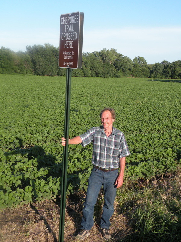
Left: Landowner Lauren Flaming with the sign marking the Sand Creek Crossing of the Cherokee Trail southeast of Goessel.
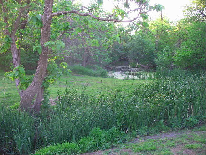
Sign placed by the Friends of the Cherokee Trail--Kansas. Above: The Wolf Camp site just south of Goessel on the Emma Creek, as documented in the book, "The Cherokee Trail Diaries" by Jack and Patricia Fletcher. |
